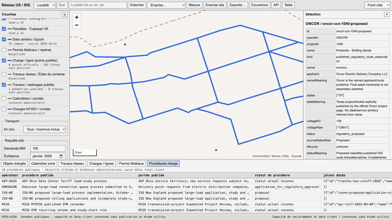
The working GIS: published routes, source records, and large-load procedures.
01 / The decision
A site is only useful if power can reach it.
A potential data center site needs a view of the transmission network, planned upgrades, and the process for connecting a large load. The public evidence is spread across utilities, regional operators, and regulatory filings.
US Grid GIS brings those records into a map that a person can inspect, query, and export.
02 / The tool
Follow the record.
Explore
Navigate US grid infrastructure and published project routes. View local context alongside the underlying records.
Inspect
Read published milestones, source dates, project status, and large-load procedure statements. Keep their original meaning visible.
Reuse
Query the API, export records, and download the source archive to inspect or run the software.
03 / The evidence
Known. Constrained. Unknown.
Published routes carry their source meaning. Administrative milestones, construction updates, and forecasts of electrical service remain separate observations.
Available capacity and a particular customer's connection date need published evidence or a utility study. The map keeps those gaps explicit.
The source archive makes the data handling and collection logic inspectable. Public-source attribution and reuse limits stay with the project.